

Brightwell Baldwin Community History and Archaeology Project
Brightwell Baldwin in South Oxfordshire is a spring-line settlement near the base of the Chiltern escarpment, about two miles west of Watlington. The Brightwell Baldwin Community History and Archaeology Project (BBCHAP) is a community based project being run in association with the South Oxfordshire Archaeological Group (SOAG). It is a long term research project, centred on the parish of Brightwell Baldwin but extending into the surrounding parishes. The broad aim is to research the development of this area from earliest occupation to the present day. The long term objective is to make a thorough record of the parish’s past, interpreting what is found within the context of other Chiltern spring-line settlements and that of Oxfordshire/Buckinghamshire as a whole.

“I say it's 1m further north Phil and it's my pen!”
Janet Sharpe
and Phil Carter in Brightwell Park - Roman road survey 2005
The project utilises the skills and knowledge of local volunteers from Brightwell Baldwin and the surrounding parishes, working alongside and receiving essential training in archaeological and other research techniques from SOAG archaeologists, and from professional archaeologists and other specialist advisors as necessary. The project is open to all, whether experienced or not.
The parish occupies an elevated position on a shelf of the Lower Chalk and Upper Greensand. In the south the Lower Chalk is capped by the Wallingford Fan Gravels. In the north the Upper Greensand drops away gently to the Gault Clay vale around Chalgrove.
The Oxfordshire Wildlife and Landscape Study (OWLS, 2004) identified the landscape type as Estate Farmland: a rolling agricultural landscape characterised by country houses set in ornamental parkland, regularly shaped medium to large hedged fields, small estate villages and dispersed farmsteads. Brightwell Baldwin is a typical example of the type.
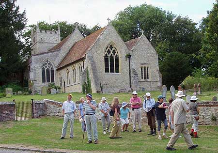
“What are we supposed to be looking at?”
Soags and villagers
at St Bartholomew's church - Brightwell village walk 2006
The parish comprises twin settlements: the small village of Brightwell Baldwin, with its largely 14th century parish church of St Bartholomew and late 18th century manor house of Brightwell Park, and the hamlet of Brightwell Upperton. In addition to the home and glebe farms of Brightwell and Upperton there are three outlying farms: Cadwell, Whitehouse and Brightwell Grove. The parish is part of the half-hundred of Ewelme. The name Baldwin relates to Baldwin de Bereford who held manors in Chalgrove, Cadwell and Brightwell in the 14th century. Before that the settlement was simply known as Brightwell, which means clear springs in Old English.
The earliest historical evidence for settlement is the Anglo-Saxon charter of 887 (S 217), in which Æthelred of Mercia grants 6 hides at Brightwell, together with outlying woods and meadows. Earlier work (Clarke, 2006) has identified the certain location of the outlying meadows and probable location for the woods, and these confirm that the Anglo-Saxon estate was smaller than the modern parish, with the northern boundary being further south in the 9th century. The deserted medieval village of Cadwell (Allison et al, 1965; Bond, 1975), in the north of the parish, remained a separate manor into the 1700s. The research collated archaeological indicators in and around the parish which suggest Romano-British settlement prior to the Anglo-Saxon, certainly at Cadwell and probably also at Brightwell, where the Roman Lower Icknield Way has been shown to pass on an east-west line through the centre of the village (Morris et al, 1968; Sharpe & Carter, 2006).

“Two Brightwell pensioners given their first walking frame!”
Ian Clarke and Don Church in Blooms field - geophysical survey 2006
Evidence for continuous occupation from Roman through to modern times was earlier amassed by A.C. Fraser (1988) but it is likely that the springs and rich soils at the base of the Chiltern escarpment attracted settlement here well before the Roman era, certainly in the Iron Age and perhaps earlier in the Bronze Age.
The research carried out by SOAG members Ian Clarke, Janet Sharpe and Phil Carter (2006) was presented to an open meeting in Brightwell Baldwin in April 2006, when parishioners were invited to join in further research. The response was an enthusiastic vote to set up a community project to build on both the recent research and the earlier historical researches of Brightwell historian A.C. Fraser and Brightwell archivist Peter Kent. Forty-five people signed up for the project, including five SOAG members, with about a third wanting to take part in some fieldwork.
Survey work since 2006 has concentrated on two areas of particular interest to the Community: Cadwell, in the north of the parish, where we have evidence for Roman occupation and the DMV, and the southern area of Brightwell Park where extensive earthworks suggested deserted medieval settlement and we have the proposed line of the Lower (Roman) Icknield Way. The results of our surveys have greatly exceeded our expectations, providing a wealth of detail to analyse. Training digs have been undertaken both in Brightwell and Cadwell. More surveying and further digging is planned for the 2010 season.
This is SOAG's first venture into the challenging world of Community Archaeology and as such it is experimental. But if we are successful it can provide a model for any number of similar projects in the future.
References
- Allison, K J, Beresford, M W and Hurst, J G, 1965 Deserted villages of Oxfordshire, London.
- Bond, C J, 1975 Deserted village: Cadwell. Field investigation, PRN 864 Oxford SMR.
- Clarke, I, 2006 The Anglo-Saxon charter of Brightwell: the land outside the bounds, SOAG Bulletin No.60 (2005).
- Fraser, A C, 1988 History of Brightwell Baldwin, Vol. 1, Unpubl, Brightwell Baldwin archive.
- Morris, C, Hargreaves, G H and Parker, R P F, 1968 The Lower Icknield Way, Oxoniensia, 33.
- OWLS, 2004 Oxfordshire Wildlife and Landscape Study, Available: owls.oxfordshire.gov.uk .
- S 217, Sawyer Number. Text available: anglo-saxons.net .
- Sharpe, J and Carter, P, 2006 The Lower Icknield Way: from Dorchester to Cuxham, SOAG Bulletin No. 60 (2005).
Project Leader
Ian Clarke.